Japan Accessible Tourism Center

home

transport

sleeping

enjoy

travel tips

link

about us

contact


perfect. no problem.
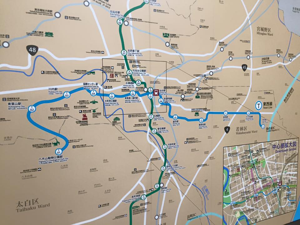
  Namboku Line     lift location   Tozai Line     lift location
N01

 Izumi-chuo

map  many lift            
N02

 Yaotome

map  taxi station            
N03  Kuromatsu map  ramp            
N04

 Asahigaoka

map  all exit   T01

 Yagiyama Zoo

map  west, central
N05

 Dainohara

map  bus stop   T02

 Aobayama

map  all exit
N06

 Kita-Sendai

map  northwest   T03

 Kawauchi

map  all exit
N07  Kita 4 bancho map  northwest   T04  International Center map  north, west
N08

 Kotodai-koen

map  north1, south2   T05

 Omachi Nishi-koen

map  all exit
N09

 Hirose-dori

map  east1   T06

 Aoba-dori Ichibancho
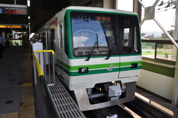
map  all exit
N10

 Sendai

map  exit central2
 exit north8
 bus terminal
  T07

 Sendai

map  exit central2
 exit north8
 bus terminal
N11  Itsutsu-bashi map  south   T08  Miyagino-dori map  south
N12

 Atago-bashi

map  east1    T09

 Rembo

map  east, central 
N13

 Kawaramachi

map  north1    T10  Yakushido map  all exit
N14  Nagamachi 1 chome map  all exit    T11  Oroshimachi map  all exit
N15

 Nagamachi

map  south1,2     T12

 Rokuchonome

map  all exit  
N16

 Nagamachi-minami

map  east1, west2    T13

 Arai

map  flat 
N17

 Tomizawa

map  all exit             


Sendai city transportation Bureau English official website